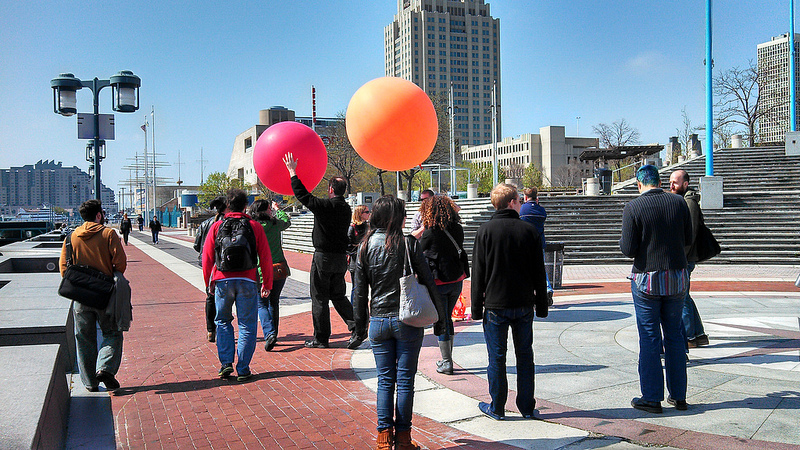
If you wanted to create detailed aerial maps on your own, you could do worse than a camera on a balloon.
That’s why two dozen people were on Penn’s Landing last Wednesday for a Philly Tech Week-inspired Balloon Mapping Workshop. Led by freelance mapmaker Dana Bauer, New Jersey state GIS staffer Sean McGinnis and a host of partners from the Public Lab, The Hacktory, Hacks/Hackers Philly, Delaware River Waterfront Corporation, the Philadelphia School District and Knight-Mozilla OpenNews.
Find more than 600 images taken by the balloon-cameras on Flickr here and photos of the event itself here.

One of 600 images taken by the balloon mapping cameras.
Armed with two oversized helium-filled balloons that carried cameras that took photos below every two seconds (resulting in more than 600 all told), the group let them fly to collect images that are now being stitched together to create a digital map. After the balloons were collected, the group went back to School District headquarters at 440 North Broad Street to learn about mapping software and hardware hacking.
This event wasn’t the only Philly Tech Week get-together with a planning focus — the city’s planning commission held a discussion on civic engagement and GIS specialist Sarah Cordivano, who just left a job with the city for Azavea, led a ‘Very Spatial Happy Hour‘ that pulled more than 60.
“The really special thing about this event was the large number of organizational partners,” wrote Bauer in an email. When Technically Philly spoke to Bauer after the event, she talked about the balloon affair with her signature kind of energy about mapmaking, managed by her curious smile and glasses.
“We had a broad range of folks attending the workshop: geographers, teachers, software developers, landscape architects, urban planners, photographers, engineers, professors, graduate students and journalists,” she went on.
Also find NewsWorks coverage of the event here.
Join our growing Slack community
Join 5,000 tech professionals and entrepreneurs in our community Slack today!
Donate to the Journalism Fund
Your support powers our independent journalism. Unlike most business-media outlets, we don’t have a paywall. Instead, we count on your personal and organizational contributions.


