GIS and GPS technology have taken root in an unexpected place in city government.
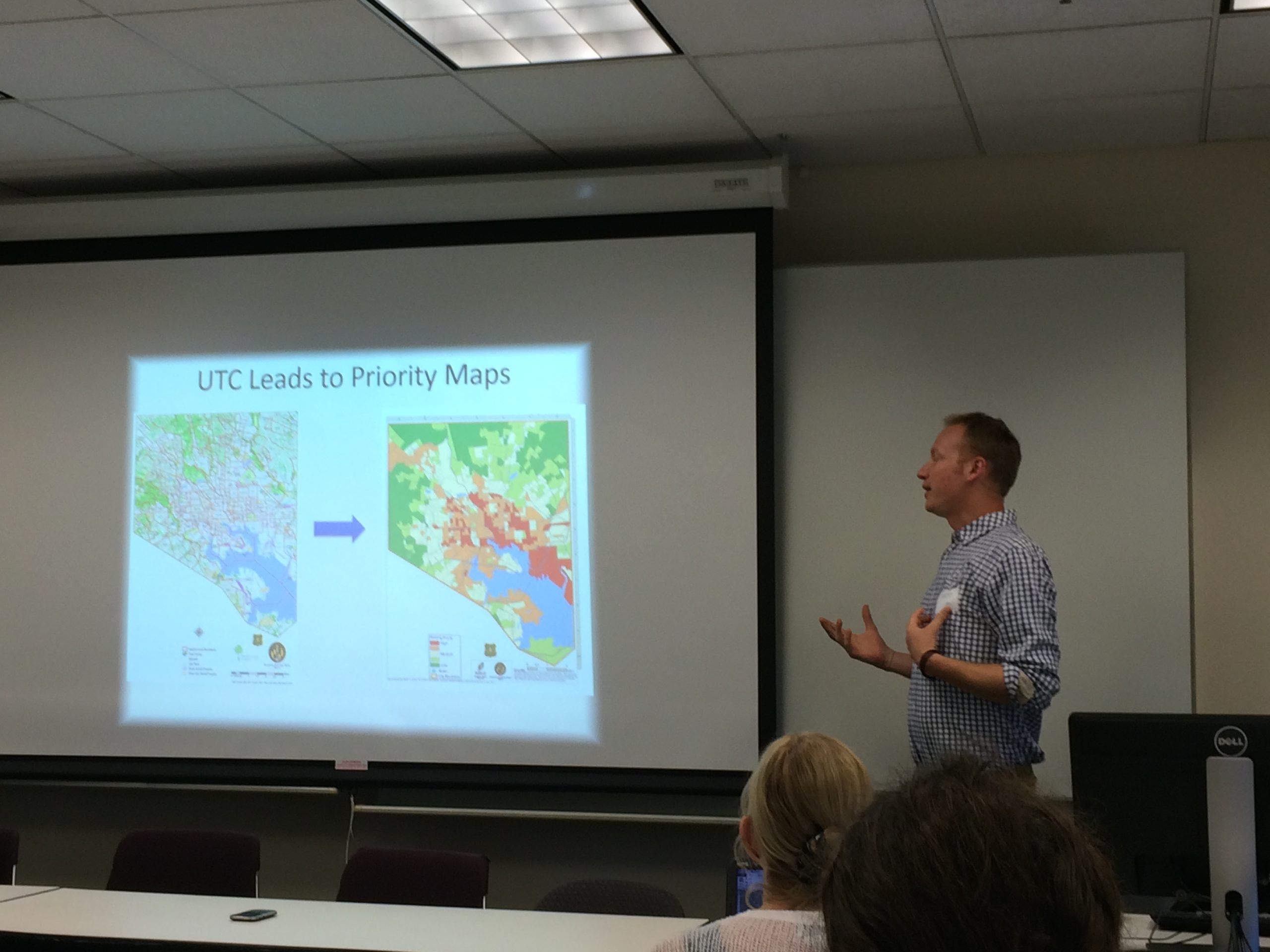
TreeBaltimore, a project of the city’s department of recreation and parks, was one of the topics of discussion during this year’s Baltimore Data Day, held Friday at the University of Baltimore. Charles Murphy, greening coordinator for the agency, spoke during a panel on sustainability.
Murphy said that new technology has made his agency more efficient. Where once trees were tracked with Excel spreadsheets and street addresses, the agency now uses GPS and GIS technology to track:
- where trees are going in,
- when they go in
- and “better, more detailed data on survivability,” Murphy said.
“The more data we collect, the more we can figure out what is going wrong and what is going right,” he said.
Baltimore, Murphy said, currently has an urban tree canopy rate of 27 percent, with a goal of 40 percent by 2037 (43 percent of the city is covered in hard surfaces).
To work toward the goal, TreeBaltimore works with residents and groups to get young trees into communities. You can request free trees through TreeBaltimore’s website. In addition, the agency organizes plantings in neighborhoods prioritized by factors including need, impervious surfaces and crime rate, Murphy said.
Data Day is an annual event organized by the Baltimore Neighborhood Indicators Alliance, an initiative of UB’s Jacob France Institute.
Before you go...
Please consider supporting Technical.ly to keep our independent journalism strong. Unlike most business-focused media outlets, we don’t have a paywall. Instead, we count on your personal and organizational support.
Join our growing Slack community
Join 5,000 tech professionals and entrepreneurs in our community Slack today!

The person charged in the UnitedHealthcare CEO shooting had a ton of tech connections

From rejection to innovation: How I built a tool to beat AI hiring algorithms at their own game

Where are the country’s most vibrant tech and startup communities?

