This is the fourth story in a multi-part series looking at the state of police IT: where it’s been, what’s it like now and where it’s going. Find the other stories in the series here.
Philly’s cops are still using old school pushpins and paper maps to track crime patterns, but a new crime mapping system aims to change that.
Launched last month, the system gives cops immediate access to location-based crime data, allowing them to visualize crime patterns and use that information to guide how they patrol the streets. Project manager Grant Ervin calls it “the biggest public safety GIS in the country” since it will eventually support the Fire Department and city’s Office of Emergency Management as well.
The Philadelphia Police Department has had a crime mapping, or geographic information system (GIS) since the mid-90s, but the system is now so outdated and slow that cops often have to ask the department’s GIS unit to make and print out specific maps for them, said Ervin. That process limits what cops can do with the data — paper maps are, of course, not interactive, and it also adds an extra step of work for all the staffers involved.

In fact, when Technically Philly visited Ervin’s office at police headquarters to demo the new system, Ervin couldn’t even pull up the old system to show us because the server kept timing out. Ervin had to call one of his staffers to reboot the server, but even after that, it wouldn’t work. Chances are, Ervin said, it’s even slower in the police district offices.
Robert Cheetham, founder of GIS firm Azavea who was part of the team that developed the Police Department’s original crime mapping system, was blunt about the shortcomings the 90s-era software.
“A lot of what I built is still in use,” he said about the system, the brainchild of Charles Brennan, the department’s first Deputy Commissioner of Science and Technology. “That’s really bad.”
Cheetham added that the system “desperately needed to be replaced” and that he was really happy to hear about the department’s progress on a new system.

Here’s what the new system, which took roughly two years, $260,000 and five to seven staffers to build, has to offer, according to Ervin:
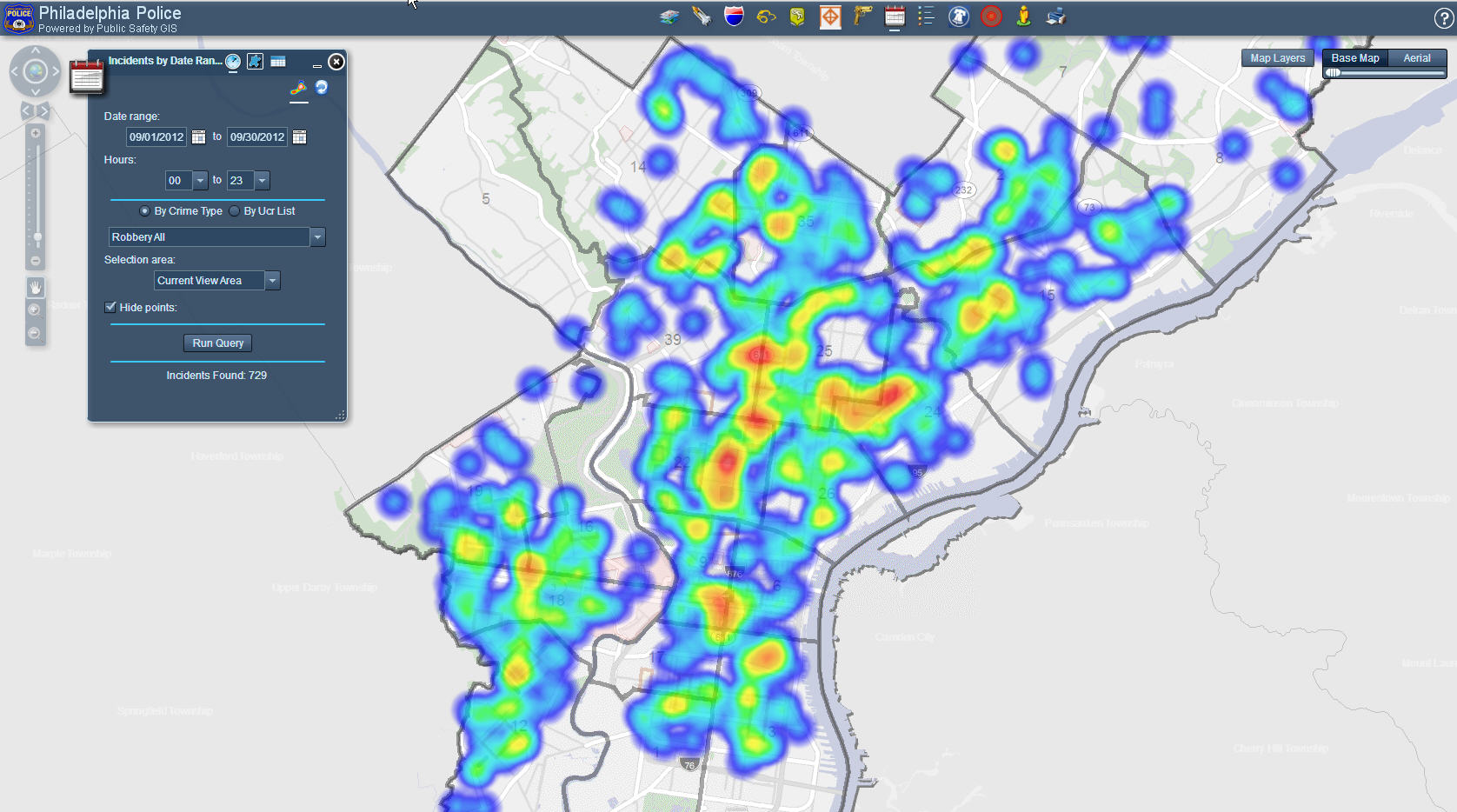
- Access to tons of data. Here’s just a taste of the new system’s functionality: If a police captain wants to see where all the bars are in the 9th Police District, all he has to do is a click a few buttons in the new system. He can then use the system to see all the robberies in the past month to see if there’s any correlation between bars and robberies. If there seems to be a pattern, he can then pull up all the 9th District’s foot patrols to see where he should assign more cops. The old system could only display four different types of crimes, Ervin said. The new system also allows you to compare crime data from different time periods and create heat maps based on crime density.
- No lag time in between requesting data and getting it. With the new system, cops won’t have to call up the GIS unit to ask for maps with the data they need.
- Cross-departmental cooperation. This system will serve as the basis for GIS for both the Fire Department, which Ervin said didn’t even have a GIS staff until last year, and the city’s Office of Emergency Management. This means the city can be more efficient, by doing more with less, Ervin said. Instead of having three teams managing three different systems, which would be costly, one team will manage all of the systems. What’s more, staffers won’t have to rebuild the system for each agency.

The rollout process has already begun and will take three to six months, Ervin said, which includes training the officers on how to use the new system. One of the biggest challenges will be “restoring faith” in the system, Ervin said, since it was previously so unreliable. But hopefully, cops will warm to the new technology.
“We don’t want people to put push pins in paper maps anymore,” Ervin said.


