
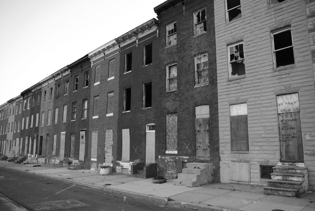
The prevalence of blight and vacant housing in Baltimore is one of the city’s bellwether issues.
Seeing entire blocks of boarded-up houses, like the one across from the Western District Police Station where many Freddie Gray-related protests took place, makes the problem highly visible. And vacant houses tell the story of Baltimore City’s struggles. They are directly connected not only to poverty and disinvestment, but also the crime that can take root in the empty properties.
One way to look at just how deep the problem goes is to map it.
Last week, INSEAD economist Amine Ouazad produced a map that made the rounds on outlets like The Atlantic’s CityLab. The map shows the number of Baltimore vacant properties, based on the U.S. Census Bureau’s American Community Survey data. The 2010 Census put the number of vacant houses at just north of 16,000.
To magnify Baltimore’s blight, Ouazad includes data for the entire metro area. The result is a fairly stark difference between the City and surrounding counties.
And, as Ouazad notes in a blog post, the two areas aren’t that far apart geographically.
“Interestingly, Rosedale is a more than 70% white and middle-class suburb, which sits right next to inner-city neighborhoods where a fifth to a quarter of all houses are vacant,” he writes.
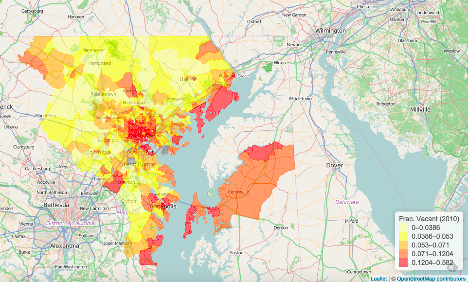
Amine Ouazad’s map of Baltimore vacant houses. Dark red represents the highest density of vacants.
But Ouazad’s map doesn’t exist in a vacuum. In 2012, local GIS specialist Elliott Plack produced a map that plots all of the city’s vacant houses.
And the visualization is ongoing. Justin Elszasz, who works with civic data at The Training Set, has also been tackling blight data. Like Plack, Elszasz turned to Baltimore City’s open data portal. Mapping only the city in “heatmap” style shows some of the same stark divides that Ouazad notes, only it becomes more clear that they’re visible within city limits, as well as across the county line. Elsasz also includes vacant lots, which he numbers at more than 17,000.
Taking things a step further, Elsasz also looked at the proximity of vacant houses to schools.
“The analysis suggests that about 68% of all vacant buildings in Baltimore are within a quarter mile of a city school, while about 27% of all vacant parcel area is within the same distance,” Elszasz writes.
Kids’ everyday proximity to the abandoned property is an “emergency of the highest order,” Elszasz writes, but also a fact that suggests it might be time to give the properties to schools that can do something with it.
Join our growing Slack community
Join 5,000 tech professionals and entrepreneurs in our community Slack today!
Donate to the Journalism Fund
Your support powers our independent journalism. Unlike most business-media outlets, we don’t have a paywall. Instead, we count on your personal and organizational contributions.

Maryland firms score $5M to manufacture everything from soup to nanofiber

National AI safety group and CHIPS for America at risk with latest Trump administration firings

How women can succeed in male-dominated trades like robotics, according to one worker who’s done it
