Last week, Upper Chesapeake Insurance Agency posted the latest drone video of Baltimore, and SouthBmore.com spotted it last night.
This effort focuses on ZIP code 21230, which spans South Baltimore from Morrell Park to Fort McHenry.
Upper Chesapeake Insurance Agency’s Gunnar Lindberg produced the video, and handled the drone piloting on lunch-break film shoots during the summer, said fellow agent Kathleen Carr, who helped with filming.
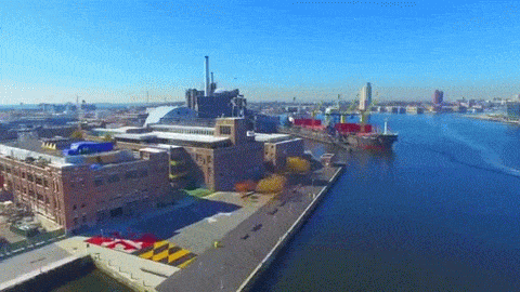
Along with dramatic shots of the Baltimore Museum of Industry and the harbor, we also couldn’t help but think of it as something of a historical document. With Kevin Plank set to redevelop Port Covington and other projects like Stadium Square and Anthem House in the works, the next drone video of the area may look a lot different.
Carr said the idea behind the video was to “showcase the great stuff” about Baltimore, specifically in the neighborhood where the agency has been for nearly 20 years.
https://www.youtube.com/watch?v=0H9MSyFK6eY
Just watch this glorious drone video of South Baltimore
With a handful of big development projects in the works, the next drone video of the area may look a lot different.