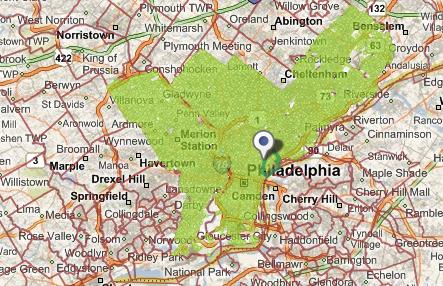
Philadelphia is crowdsourcing a census of its trees, and, yes, would you mind helping?
Unveiled on Arbor Day during Philly Tech Week, PhillyTreeMap.org is a wiki-inspired web application that allows users who register free to collaborate with the project partners — City of Philadelphia Parks & Recreation, the Pennsylvania Horticultural Society, and the Delaware Valley Regional Planning Commission – to map, inventory and preserve the Philadelphia urban forest. The project was built by local mapping company Azavea.
Nearly 180,000 are already cataloged, though the species and other core details are missing.With guidance from the site, users can ascertain species type, estimate trunk diameter and height and fill in other specifics that will help the coalition of groups to better ascertain what is lacking and what is working in Philadelphia foliage.
PhillyTreeMap is meant to help Parks & Rec with its 30 percent tree canopy goal outlined in Greenworks Philadelphia by engaging residents around tree planting and stewardship, Azavea Project Manager Deb Boyer said during the Green Tech Showcase unveiling. Currently Philadelphia has an average of roughly 20 percent canopy across the city, though some parts have fuller coverage and other parts have far less.
Funding has not yet supported a mobile interface, which would allow users to more easily update entries while at the tree, Boyer said, but the browser experience is a user friendly one. Team members will offer some project oversight in case of false information, but the hope is for Philadelphians to help with this cause, she added.
According to a press release [PDF]: “Azavea built PhillyTreeMap using open source code contributed by the Urban Forest Map project in San Francisco and plans to collaborate with the group on future urban forestry projects. The development of PhillyTreeMap was supported by a Small Business Innovation Research (SBIR) award from the U.S. Department of Agriculture National Institute of Food and Agriculture.”
PhillyTreeMap.org: crowdsourced census of Philadelphia’s tree canopy


