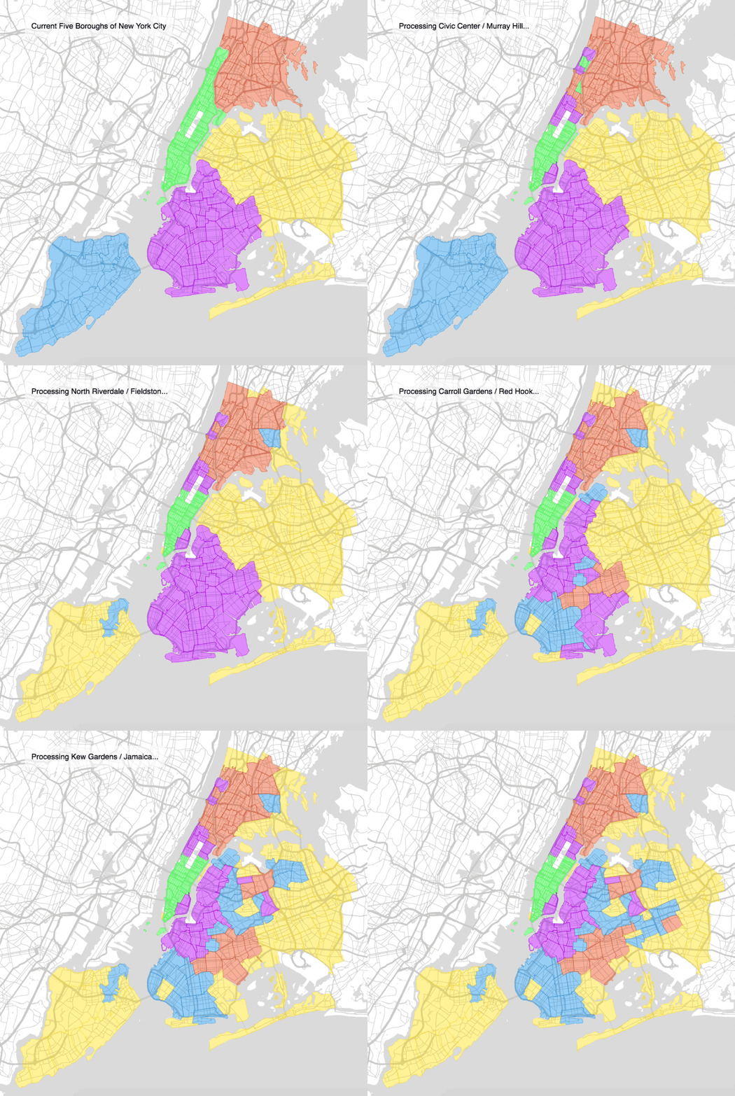
The five boroughs of New York have existed since 1898, when the city was consolidated, so mapping company Topos decided it was time to revisit the map.
Combining artificial intelligence, data and something it calls “computer vision,” the company redrew the map of the five boroughs and gave them new names, based on which parts of the city shared the most similarities.
“As part of this endeavor, we have constructed a suite of features and indices about neighborhoods and cities that encompasses everything from topological analysis of urban form, to ambient light levels, to the prevalence of craft cocktails within a neighborhood.”
Here’s what they came up with:
Minhattan
- “In addition to being the most densely populated (with 69k residents/square mile), Minhattan has a higher density of most types of establishments (from museums to nightclubs) than any other borough. Alongside this incredible commercial, institutional and population density there is a corresponding absence of the natural world.”
The Ring
- “The Ring tightly hugs Minhattan, and on average is the closest borough to the center of Minhattan, with housing prices to match: after Minhattan, it is the most expensive borough to buy a house in. Unlike Minhattan, The Ring spans multiple rivers. It also unites isolated neighborhoods embedded in other boroughs that are quite far from the center of The Ring such as Forest Hills, Inwood and Hudson Heights.”
North Bend and South Bend
- “They share remarkably similar average distances to downtown Manhattan, with South Bend neighborhoods an average of 7.92 miles away and North Bend neighborhoods an average of 7.86 miles away. North Bend is more densely populated than South Bend (46,694 residents/square mile vs 33,367 residents per square mile) which may explain another aspect of what differentiates them: South Bend has a far higher frequency of noise and party complaints.”
The Meadows
- “The Meadows is farthest away from the heart of Minhattan, and is sparser than the rest of the city in every regard. There are 12,050 people per square mile (vs Minhattan’s 69,390, a nearly 600% increase). Like Minhattan, The Meadows is clearly differentiated by d1; the natural environment asserts itself more strongly, as can be detected via image recognition technologies. Additionally, image recognition algorithms discern the frequent presence of traditional suburban style houses in The Meadows, revealing a side of New York City that is less frequently presented in depictions of the city.”
The whole post, which includes some New York history and a discussion of methodology, is worth a read.
Read the full storyJoin the conversation!
Find news, events, jobs and people who share your interests on Technical.ly's open community Slack
