Pennsylvania’s beekeepers can now get even closer to their six-legged friends.
In April, Penn State University, with the help of Callowhill-based geospatial technology company Azavea, released a new tool called Beescape where keepers can get the buzz on their hives (sorry) with a “bee’s eye view” of their environment.
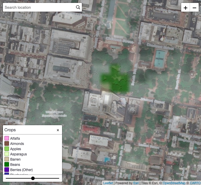
Current keepers or those hoping to start a hive can input their colony’s GPS coordinates, and Beescape will tell them the number and types of pollinators, area pesticide use and any other crop factors. Although most know the immediate land around their hive, bees can travel up to five kilometers from their colony, so keepers can be in the know about the entire area that their insects frequent.
“This [tool] includes indices of nest site and floral abundance, or from the bee’s perspective, a landscape’s capacity to provide ‘room and board,’” said D.J. McNeil, a post-doctoral student at Penn State working on Beescape.
Considering the U.S. Department of Agriculture’s announcement earlier this week that it’s no longer tracking the plunging honeybee population, you could say that any extra data is the bee’s knees (sorry). Beescape is the first of its kind in Pennsylvania, although Delaware keepers can use BeeCheck to track info on state registered beehives.

The partners’ current “backbone” data comes from a nationally developed USDA data set, called crop layer. Once they’ve put in their location, keepers can see scores of their environment to help decide whether or not to move hives, plant additional pollinators or have a friendly neighborhood chat with fellow farmers using pesticides. The goal is to have a higher score in foraging and nesting data while decreasing insecticide scores.
Plus, the site accepts user data on “wild bee hotels,” aka artificial nests people create for native bee species, aka Airbnbees (not sorry).
Azavea software client developer and former Germantown beekeeper Matt McFarland said that Penn State reached out to Azavea after seeing the company’s previous work on a tool for all species of bees called Pollination Mapper done with University of Vermont and ICP Bees. (Fun fact: Azavea has three beehives on its roof.)
They’ve already secured funding for phase two of the project, which can begin after they’ve collected enough data.
“Instead of user clicking on maps and evaluating,” McFarland said, “the next version would analyze landscape itself based on how they’ve observed hives fairing under certain conditions. So it will be more predictive than evaluative.”
Keepers can also participate in a survey twice per year or monthly about the health and management of their hives, which McFarland said they can use to directly correlate landscape factors with bee health.
Once they’ve released phase two, Penn State and Azavea are hoping to expand to include data from all 50 states. They currently have info on Pennsylvania, Illinois and Indiana and will be adding data from Wisconsin, Michigan, Ohio, New York and West Virginia.
Overall, the project hopes to increase awareness about bee habitats to help the at-risk honeybee population.
“Given the ongoing conservation crisis related to bee population declines, a bee-centric view of habitat quality may profoundly affect how we view landscapes,” McNeil said. “For many users, Beescape provides a data entry platform and record database for their colony data which we, as researchers, use to produce actionable conservation science to benefit bees.”


