
Living in Washington, D.C., history is all around us. Sure, I live just a few blocks from the grand old government buildings on Capitol Hill. But I don’t even need to go that far to see historical works of architecture — the row homes across the street from my address were originally built in the 1890s.
I know this because I looked them up on HistoryQuest DC, an interactive GIS map of the District’s 127,000 extant buildings. It’s a project of D.C.’s Historic Preservation Office.
See the map
“The map offers several operational layers of data for the reader,” the website states, “including historical data on individual buildings, information on properties listed in the D.C. Inventory of Historic Sites and the National Register of Historic Places, information on current-day neighborhood boundaries, historic residential subdivisions, the L’Enfant Plan Boundary, Squares, and Wards.”
Whew.
Practically, it works like this: Click on a given building on a map and you’ll be given all of the information that the Historic Preservation Office has on that particular location — date built, architect, original owner and more. The default layer on the map shows buildings according to when they were built (the darker in color, the older they are), but users can also filter to see only historic landmarks or buildings that are part of the National Register of Historic Places and the like.
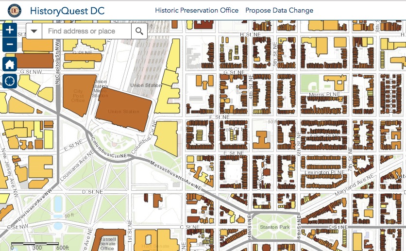
Checking out my historic ‘hood. (Screenshot)
It’s pretty cool.
According to Popville, this map first made an appearance about a year ago, before promptly going offline. It’s now back and better than ever. For its part, the Historic Preservation Office says the map is still a work-in-progress — there are still various areas of the city that haven’t been fully mapped. The Office plans to finish up by the end of 2017.
Map enthusiasts take note, though — you can help make this map even greater by proposing a data change on the site or by emailing the Historic Preservation Office at historic.preservation@dc.gov.
Join the conversation!
Find news, events, jobs and people who share your interests on Technical.ly's open community Slack

DC daily roundup: Appian's new AI tools; Foxtrot stores abruptly shutter; Sublime Security raises $20M

DC daily roundup: Startup founders offer praise; Howard U breaks application record; NavalX gets new director

DC daily roundup: Washington Post's AI collab; a greentech glossary; Halcyon's debut Climate Fellowship cohort
