
Did you know Brooklyn is home to 2.6 million people and 177,531 trees (at least)? Or that south Brooklyn and bayside Brooklyn is quite a bit leafier than the waterfront neighborhoods?
They city’s parks department released a map off all the trees in the city earlier this year. It’s an incredible document that allows users to go down to a block level and see each individual tree. My block has northern red oaks, ginkgos, green ashes and flowering dogwoods.
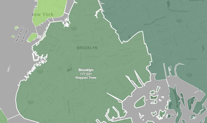
NYC Street Tree Map. (Screenshot)
The map’s data comes from a 2015 volunteer effort to collect data on all the city’s trees called TreesCount! According to the survey, the most popular tree in Brooklyn is the London plane tree, which makes up 20 percent of the trees here. In total there are 181 species of tree.
“Volunteers used the TreeKIT mapping method to produce accurate measurements of our street trees, including identifications of species and tree diameter,” according to the department.
Join the conversation!
Find news, events, jobs and people who share your interests on Technical.ly's open community Slack