Ahead of next month’s launch of the new BaltimoreLink bus system, the city is seeing new lanes for buses only and even buses that educate people about the new bus routes.
But it was tough to really visualize it without a cool new map.
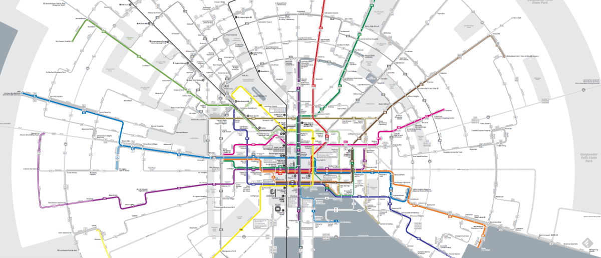
Luckily, the MTA and designer Marc Szarkowski provided that. Here’s where to view it (PDF).
The map of the system is in diagrammatic radial style, according to Greater Greater Washington. The transit-loving site appeared to like it.
https://twitter.com/ggwash/status/864182618929209348
The approach isn’t just to show off a fancy design toy. The map is designed to reflect how the system’s redesigned bus routes cluster in the downtown grid, then radiate out in each direction. It’s also designed to make it is easier to decipher the routes.
BaltimoreLink debuts June 18.
New bus system, new map: see it here
The BaltimoreLink map shows how routes radiate out from the center of the city.