
What started with protests following weeks of tension related to the death of Freddie Gray has turned more far flung and violent.
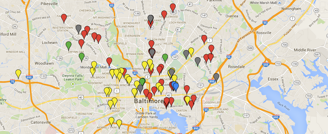
There have been fires and looting and other crowd activity. Here’s a map someone has begun for collecting data on where alarms and fires and looting have been reported from yesterday into today. You’ll see how widespread the reports are, though surely there are more spots not yet listed, as this moves quickly.
The map was launched and is being updated by civic hacker Shea Frederick and Hopkins data scientist Ryan Smith.
Also find discussion over at the Real News Network.
Before you go...
Please consider supporting Technical.ly to keep our independent journalism strong. Unlike most business-focused media outlets, we don’t have a paywall. Instead, we count on your personal and organizational support.
Join our growing Slack community
Join 5,000 tech professionals and entrepreneurs in our community Slack today!

This Week in Jobs: Fall from the coconut tree and check out these 22 career opportunities

Gen Z pivots to gig jobs instead of full-time work: Who is that good for?

Baltimore Money Moves: Under Armour to pay out $434M in class-action settlement
