How thorough is New York’s subway system? Where doesn’t it reach?
Brooklyn’s King of Maps, Chris Whong, returns with Subway Deserts v2, a map of the city’s subway lines, and the areas around them within a 10-minute walk. It shows where in Brooklyn is covered by transportation, and where isn’t, and the findings might surprise you somewhat.
A few neighborhoods stand out for being poorly served by the subway. In Bedford Stuyvesant there’s a triangle between the JZ, the AC and the G where dozens of blocks from Nostrand Avenue to Malcolm X Boulevard are inaccessible. The G splits Greenpoint, but on either side is desert, and don’t even think about trying to get to the Navy Yard or Red Hook on the train. Trains and money. (Screenshot)
“This map shows the combined areas forming a 10-minute ‘walkshed’ around NYC’s 470 subway stations,” Whong writes. “The walkshed has been given the same styling as the water areas, revealing the ‘subway deserts’ of New York.”
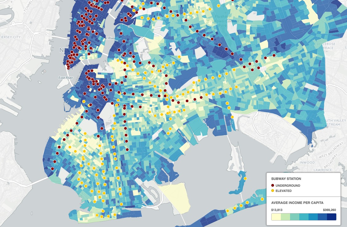
We were interested to see if the transportation deserts aligned with income, so we went looking for another CARTO map and found Income and Distance to Subway in New York City by CARTO user Samhudis and found out that in plenty of cases they don’t align.
Take South Williamsburg. A transportation-rich area — bounded by the JMZ, G and L trains — it is one of the poorest neighborhoods, as measured by average income per capita, in North Brooklyn. Conversely, Red Hook is quite a wealthy neighborhood while being essentially completely a transit desert. Bergen Beach, which isn’t remotely close to any trains, is one of the wealthiest areas in southern Brooklyn. And you can really see the impact of the F train through Borough Park and Midwood, where average income is high close to the train and low away from it, more or less in a straight line south. Also we see that the areas closest to the water all along the East River in Brooklyn are more than 10 minutes from the train are also some of the wealthiest.