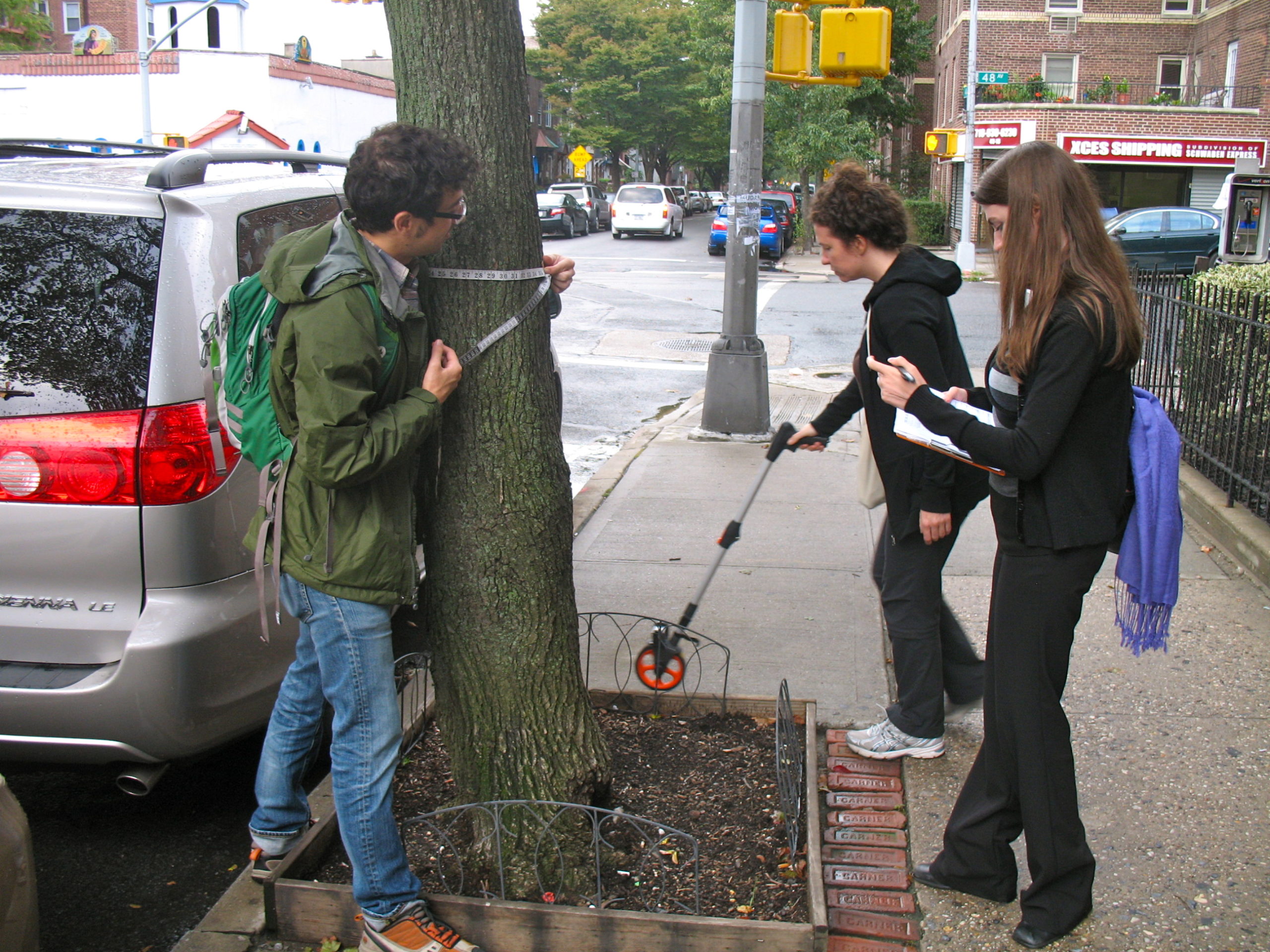
Local hackers behind a tree location system have won over the NYC Parks Department.
Before we get into the story, let’s start with what’s important: If you think trees in the city are good, it’s important that city officials know exactly where every single one of those trees is. It’s important that everyone who cares about trees knows, and this summer is the summer to make that happen.
Register as a volunteer tree counter
Every ten years, New York City counts all the city’s street trees.
This is especially important, because, since the Bloomberg administration, the city has been planting trees at a frenetic pace (949,361, so far, according to the effort’s website).
Which brings us to the story: A couple of volunteers here in Brooklyn realized that tree maintenance is tough in a big city, and if it were to be done well, volunteers would have to do a lot of it. The trouble is that there were coordination issues, so they built TreeKIT as a way to begin keeping track of trees on a map.
We wrote about this in October 2013. Volunteers are trying to map every single street tree in this enormous city. They have mapped thousands and thousands and thousands, but there’s still lots of the city to go.
See the map
When we last spoke, one of the project’s cofounders, Philip Silva, told Technical.ly Brooklyn that his group was pressing the city to use the TreeKIT system for its tree census. Like the people census, it only happens every ten years. 2015 is the year.
We’re going to make a confession: this sounded like a bit of a pipe dream to us. Could two smart do-gooders convince the city bureaucracy to adopt their new-fangled, mobile, tech-powered system of counting trees? It didn’t sound likely.
We were wrong.
From the city’s TreesCount! website:
The TreeKIT mapping method and the accompanying mobile app are the foundation of TreesCount! 2015. NYC Parks chose TreeKIT for TreesCount! 2015 because it is easy to use and generates a representative map of the urban forest that places the tree exactly where it is located along the curb. The mapping method has been well-tested through the many collaborations that TreeKIT has had with neighborhood-based organizations in Manhattan, Brooklyn, Queens, and the Bronx over the past five years.
Bravo. Technologically, there are two interesting elements of the TreeKIT system.
First, by going mobile, it makes it simple to just enter data once for each tree. When we spoke to Silva in 2013, city volunteers were still marking data down on paper, which had to get entered later.
When we spoke with the team in 2013, it was working with OpenPlans and CartoDB.
Since that original open source web product, the app has been re-engineered and re-designed by Philly-based mapping firm Azavea to support the large scale of the TreesCount! effort, as well as to add several new features, said Azavea founder Robert Cheetham. Volunteers will get to the web app via their phone’s browser (making it device neutral), which is where they will log the data they find while taking part in the census.

Second, the actual measurements are still analog. GPS measurement is not precise enough in a city for TreeKIT’s purposes, so they use survey equipment to measure the tree’s distance from the curb and regular measuring tape to measure its diameter at breast height. They also measure the size of the tree pit and track what kind of tree it is.
See the outcome of the previous two tree censuses here. And check out this “random collection of charismatic street trees” on Tumblr.


