
Can you imagine a streetcar running down Bedford in Williamsburg? How about Flushing down by the Brooklyn Navy Yard and Fort Greene?
The New York City Department of Transportation released a report this week detailing potential routes for the Brooklyn-Queens Connector (BQX), which has both of those already-packed streets as possibilities for the streetcar’s route.
The report notes the need for more intra-Brooklyn transport, as “emerging job hubs, strong academic institutions, and cultural institutions … shift from Manhattan-centric connectivity.”
The plan calls for 30 stops in total, about every half mile, from the top of the line in Astoria to the bottom, in Sunset Park. During rush hour, commuters can expect a streetcar every five to 10 minutes. The plan also says the route will try to create as many BQX-exclusive lanes as possible, making trips considerably faster than buses.
Some, including us, have been critical that the estimated $2.5 billion project touches primarily the wealthiest and best-connected neighborhoods in Brooklyn. Here are a few maps of the potential routes, and then below is the whole report, if you’re interested.
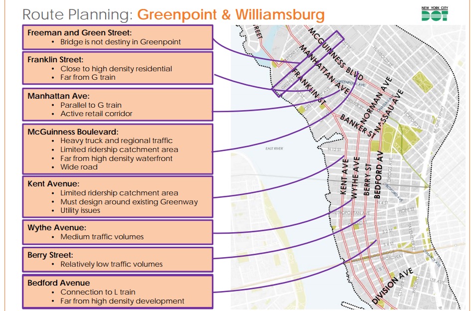
BQX Greenpoint/Williamsburg routes. (Screenshot)
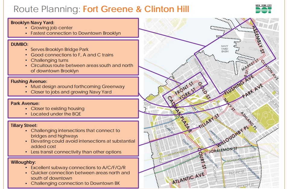
Potential BQX Fort Greene/Clinton Hill routes. (Screenshot)
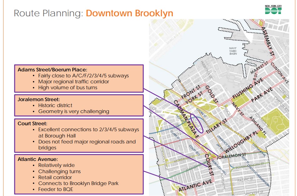
Potential Downtown Brooklyn BQX routes. (Screenshot)
Read the full report
Join the conversation!
Find news, events, jobs and people who share your interests on Technical.ly's open community Slack