In the era of “urban renewal,” many neighborhoods across New York were razed and cleared. The midcentury master-planners designated properties and blocks as “blighted,” offering up plans for improving the newly-cleared tracts. Many of those plans, however, were never executed, despite millions of dollars in federal funding to destroy buildings and relocate their residents.
Now, several decades later, a team of volunteers has worked more than 100 hours to build a map: the Gowanus-based 596 Acres has released all the old urban renewal plans on a map hosted in CartoDB.
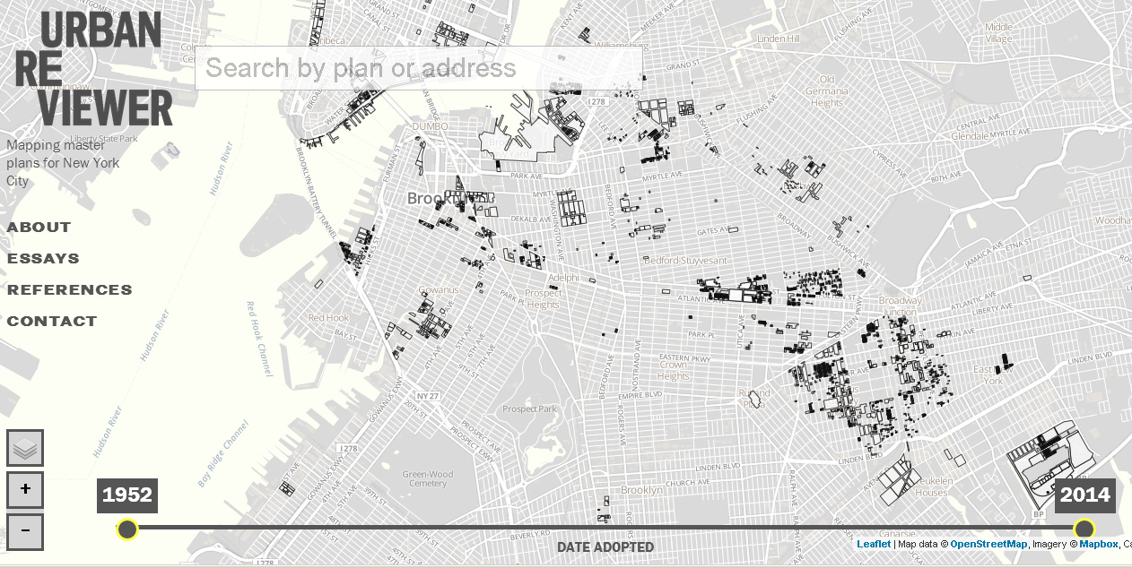
The new map is called Urban Reviewer.
Have you seen @596Acres’ #urbanreviewer tool? Great mix of maps, urban plans, NYC #opendata, & hacking! http://t.co/xYTx8OFFdd
— noel hidalgo (@noneck) June 19, 2014
//platform.twitter.com/widgets.js
We previously wrote about the organization’s move to Brooklyn.
596 Acres has already used information found in these plans to open up spaces to the public. Executive Director Paula Z. Segal wrote in a press release about the new resource: “Making plans accessible helped us find places that were cleared with the intention of creating open public spaces,” she said. “In our work through 596 Acres, we have already found two of these and helped neighbors transform them into something better.”
One of those spaces has become the Keap Fourth Community Garden in South Williamsburg. Plans were used to justify transferring its stewardship to the city’s Parks Department.
Join the conversation!
Find news, events, jobs and people who share your interests on Technical.ly's open community Slack