Mapping the density of invasive vines over park land that amasses to some 1,400 acres is no small task, even for geographic information systems (GIS) developers trudging through the underbrush with smartphone in hand.
But the Invasive Vine App now being piloted by Boomerang Geospatial takes a fairly common technology employed by GIS developers — mapping — and uses it to depict on the acreage of invasive vines in Gwynns Falls/Leakin Park that have killed neighboring trees. To date, the app team’s map has revealed that roughly 42 acres worth of trees have been overrun by invasive vines.
The app itself is one of six projects chosen in the city’s first civic hacking competition, Hack the Parks, which solicited entries for projects that would improve Baltimore city parks. The entries didn’t necessarily require a technological bent to be considered, and indeed one entry is a public art installation of painted trash cans in Patterson Park, as Technically Baltimore reported.
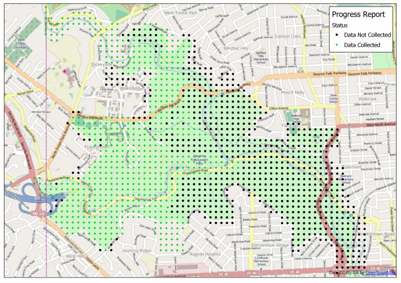
At the top of this post is a map of the roughly 650 acres of Gwynns Falls/Leakin Park for which the Boomerang Geospatial team has collected data on the proliferation of invasive vines. Read more about the project at the gb.tc blog.
Join the conversation!
Find news, events, jobs and people who share your interests on Technical.ly's open community Slack

Baltimore daily roundup: B-360's policy moves; a foundation's fight for financial inclusion; Digital Navigator training

Baltimore daily roundup: Johns Hopkins dedicates The Pava Center; Q1's VC outlook; Cal Ripken inaugurates youth STEM center

Baltimore daily roundup: Scenes from an epic Sneaker Ball; Backpack Healthcare in Google AI accelerator; local tech figures' podcast