The team behind the Police Department‘s updated crime mapping system won a Special Achievement Award from GIS firm Esri, the Philadelphia Daily News reported.
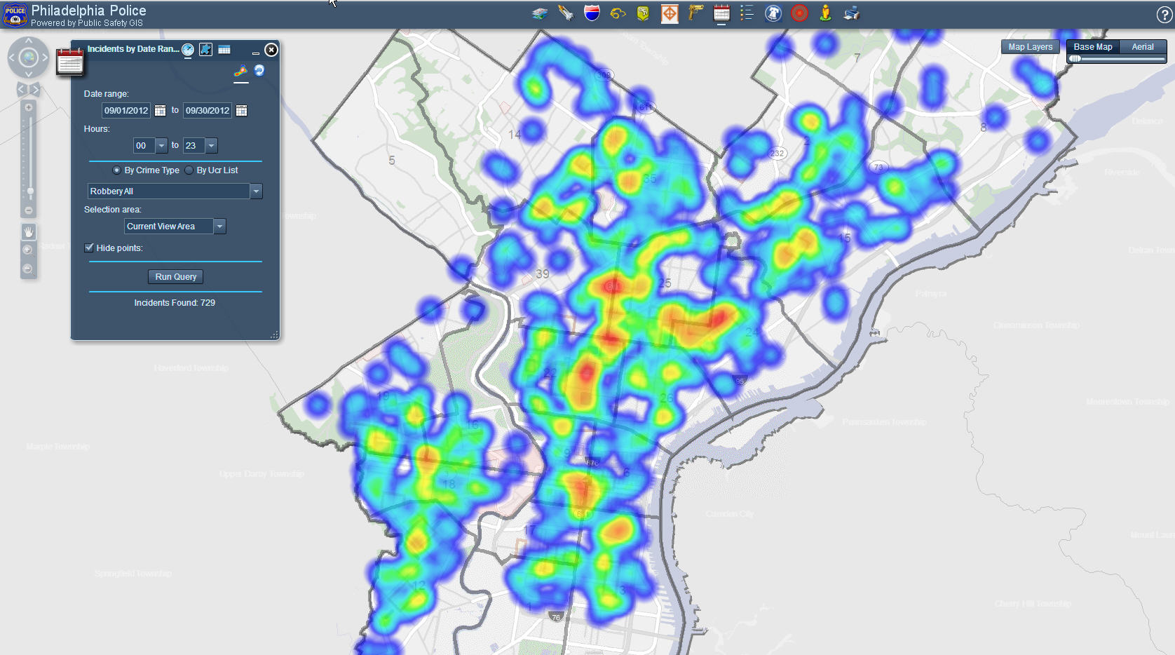
Launched in October 2012, the GIS is one part of what project manager Grant Ervin called “the biggest public safety GIS in the country,” which will eventually support the Fire Department and the Office of Emergency Management. Before the new system launched, officers used a painfully slow 90s-era mapping software or paper maps. The award-winning system took roughly two years, $260,000 and five to seven staffers to build, Ervin said.
Read more about the new system and its capabilities in our story here.
The team, composed of staffers from the Police Department and the Managing Director’s Office, will receive the award in July at Esri’s International User Conference, according to the Daily News report.
Join the conversation!
Find news, events, jobs and people who share your interests on Technical.ly's open community Slack

Philly daily roundup: East Market coworking; Temple's $2.5M engineering donation; WITS spring summit

Philly daily roundup: Jason Bannon leaves Ben Franklin; $26M for narcolepsy treatment; Philly Tech Calendar turns one

Philly daily roundup: Closed hospital into tech hub; Pew State of the City; PHL Open for Business
