An upgrade to the OpenBaltimore data website now allows users to view city data sets as maps inside their Internet browsers, as city CIO Chris Tonjes announced on the Baltimore Tech Facebook group Monday:
From his post:
In the past shape and KMZ files were uploaded as downloadable files. We have purchased an upgrade to Open Baltimore that now allows for shape and KMZ files to be viewed in the browser as maps. Users can add layers of any data set that has been geocoded and save it as a shape or KMZ file directly from the browser.
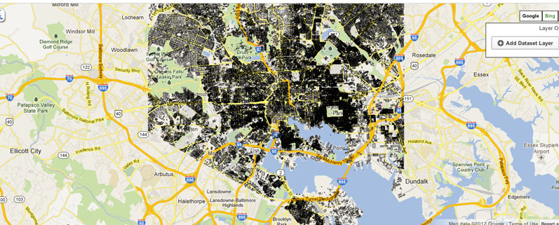
Here’s the first map created, which shows polygons representing “photogrammetrically captured building footprints including utility structures, and structures under construction and/or in ruins.”
Tonjes says the Mayor’s Office of Information Technology will keep the “100+” files up on the OpenBaltimore site as downloadable files, but will upload all the files as maps viewable online “in the coming week”
Join the conversation!
Find news, events, jobs and people who share your interests on Technical.ly's open community Slack

Baltimore daily roundup: B-360's policy moves; a foundation's fight for financial inclusion; Digital Navigator training

Baltimore daily roundup: Johns Hopkins dedicates The Pava Center; Q1's VC outlook; Cal Ripken inaugurates youth STEM center

Baltimore daily roundup: Scenes from an epic Sneaker Ball; Backpack Healthcare in Google AI accelerator; local tech figures' podcast