
There’s a new way to get Baltimore on the OpenStreetMap, and it doesn’t involve flyovers or geocaching.
The map that’s emerged as an open-source alternative to Google Maps has a bold mission to create a free and open map of the world, including address data and building names. The best way to get that data for an open-source project is through the government.
“We’re already seeing large municipalities like NYC and DC interact with their citizens via [OpenStreetMap], licensing their data so that it can be imported into OSM and maintained there for all,” Baltimore County GIS Specialist Elliott Plack told Technical.ly Baltimore via e-mail.
Local mappers have been editing the map in Baltimore for years, myself included, but it is quite consuming to survey.
The U.S. government has made data available, but local leaders have been a little slower to follow suit. Open data initiatives, like those underway in Baltimore city, are changing that. Even after the data is available, though, there remains a need for someone to upload the data onto the map.
Enter Plack and a group of other mapping devs.
A civic hacker who once created an app to calculate your Lyft fare, Plack has been working on the map as a side project. For several years, he’s been working with several other fellow map enthusiasts to fill out Baltimore’s buildings and addresses on OSM.
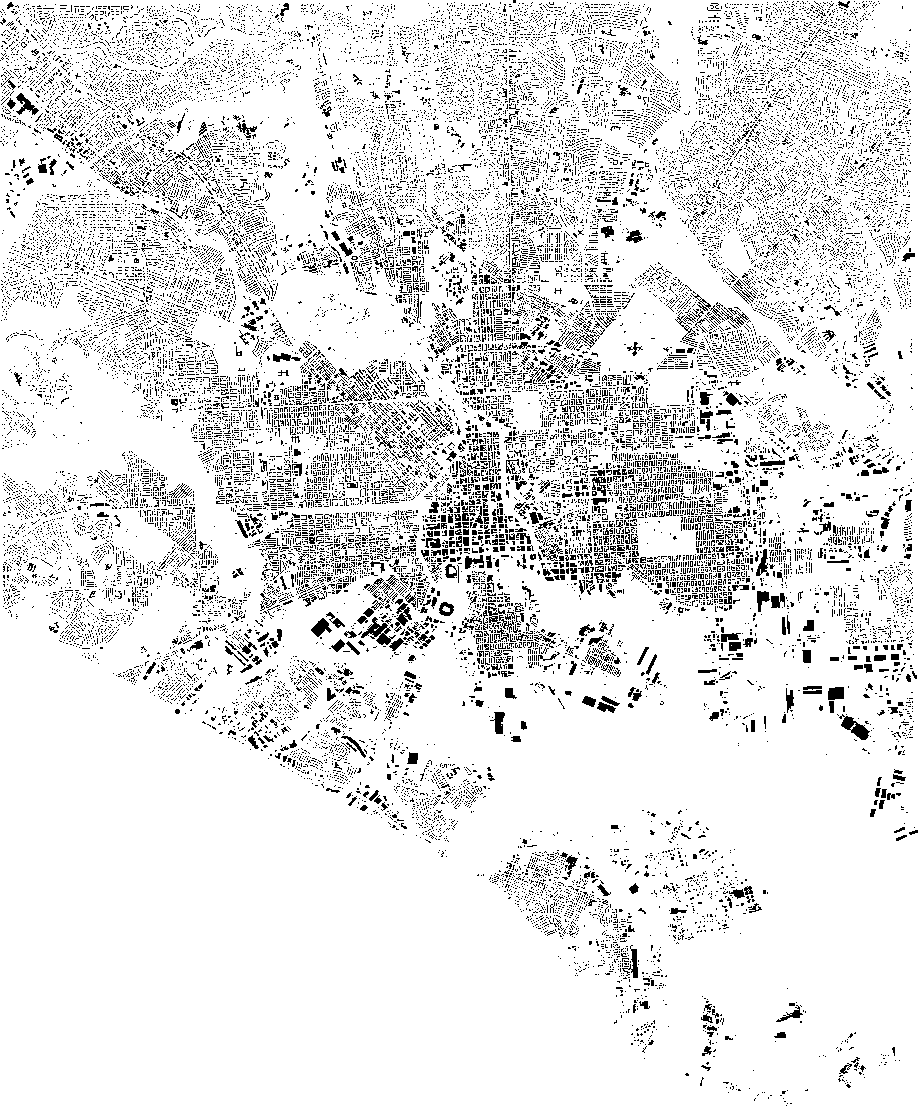
“Local mappers have been editing the map in Baltimore for years, myself included, but it is quite consuming to survey (walking around and taking notes) every address on every street,” said Plack. “Before this effort, most of the local mapping involved tracing building and roads using satellite imagery.”
Recently, however, they got access to data from Baltimore city that’s made the project more efficient.
Plack met with Jim Garcia of the Mayor’s Office of Information Technology. Garcia is helping the mappers get the data they need from the city, and provide any data that isn’t already in the City’s Open Data Portal. Plack also learned from Garcia that there is no license restriction, since the data is in the public domain.
With the data that’s now available, filling out OpenStreetMap is now a matter of getting the buildings and addresses into a format that the platform can recognize, rather than cataloging every building in the city. They have opened up the volunteer endeavor on GitHub to anyone who wants to get involved.
Help map Baltimore
The input to OSM is “fairly automated,” but the process is not without pitfalls, said Plack.
“For instance, all the street names in the city data are in ALL CAPS,” Plack said. “The standard format on OSM is Title Case, so a conversion function was necessary, and special cases have to be considered. At this point we’re working on the code to automate the backend process so that once the data is finalized, the upload can be automated.”
He used the example of “LaSalle,” which appears in many cities. To get it right, however, they must find the way it’s been used traditionally in Baltimore.
“When it’s all in caps, that’s ok enough, but when we’re talking about proper case, the decision becomes La Salle or LaSalle or Lasalle, all three of which are used around the country,” Plack wrote.
That’s where Garcia comes in.
“Jim can help us mappers find what the official city data says, by looking at plats and other records that the community mappers would be hard pressed to find,” Plack said.
The end result, Plack said, will be a map for all to use. As the municipal backing of efforts to get the data onto the map illustrates, OpenStreetMap is becoming increasingly appealing as a home of not just the visual maps, but also the data that is uploaded and layering capabilities through apps like MapBox. As Plack pointed out, Apple switched to OSM from Google Maps in 2012, and other big companies like the GPS navigation software maker Telenav have followed suit. The platform has even been used to map areas for assistance during humanitarian crises, such as during last year’s Ebola outbreak in West Africa.
If that isn’t a convincing reason to have Baltimore represented, consider this: the Baltimore County OpenStreetMap is much more complete than Baltimore city’s.
Companies:
GitHub / City of Baltimore
Join the conversation!
Find news, events, jobs and people who share your interests on Technical.ly's open community Slack

Baltimore daily roundup: An HBCU innovation champion's journey; Sen. Sanders visits Morgan State; Humane Ai review debate

Baltimore daily roundup: Medtech made in Baltimore; Sen. Sanders visits Morgan State; Humane Ai review debate

Baltimore daily roundup: The city's new esports lab; a conference in Wilmington; GBC reports $4B of economic activity